Watanabe Prefecture
Jump to navigation
Jump to search
| Watanabe Prefecture 渡辺県 | ||
|---|---|---|
| Prefecture | ||
| Nakamian transcription(s) | ||
| • Nakamian | 渡辺県 | |
| • Romanji | Watanabe-ken | |
| ||
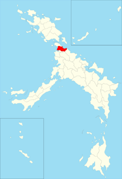
 Map of Watanabe Prefecture location toward Nakahara | ||
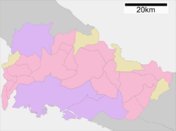
 Map of Watanabe Prefecture | ||
| Country | Nakahara | |
| Region | Kanto | |
| Island | Maejima Island | |
| Capital | Watanabe | |
| Divisions | 21 Cities, 2 Districts, 4 Town | |
| Government | ||
| • Type | Prefecture | |
| • Governor | Yoshimasa Takahashi | |
| Area | ||
| • Total | 3,103 km2 (1,200 sq mi) | |
| Population (August 1, 2016) | ||
| • Total | 8,631,056 | |
| • Density | 2,800/km2 (7,200/sq mi) | |
| Time zone | Nakahara National Time (UTC+9) | |
| Flower | Cherry blossom | |
| Tree | Cinnamomum camphora | |
| Website | pref.watanabe.go.nk/english | |
Watanabe Prefecure (渡辺県 Watanabe-ken) is a prefecture of Nakahara located in island of Maejima. Watanabe prefecture host many cities part of Greater Shinkyo including Watanabe, Kashizaki and Shimazaki.
